Unofficial Google Tools: MyGmaps/M(osele)y Blogmaps
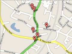
Here's a new and fun e-gadget: a Google-mapping tool that gives us the option to label points on a Google map. So, for example, one might use it to take a walking tour of Moseley, where each point is linked to an image somewhere, or linked to a website, or even just a spot on the global coordinate system.
Would be fun to have a GPS device and to go stand at exactly 52.436000,-1.865000, poke a stick in the ground, take a photo, kind of like being at the North Pole and planting a flag. Lots of games around this idea...
Would be most fun to take said GPS device and send people out on their own favourite journeys, then come back, upload the co-ordinates, and produce a series of mapped routes - personal Moseley routes with notes, photos, and who knows, maybe even a treasure hunt on the ground!
21:00
Thanks to a perspicacious Apprentice, we've now got all-spinning, all-cacheing number-crunching available. Here. So there's a potential for finding local co-ordinates online by tracking geo-cachers. The corollary step is to get some people with GPS-enabled phones or other gadgets to have a reccie around Moseley and send in the data. At that point, if someone wants to do some geo-cache-ing, they'll have the precise numbers for whatever spots they choose to leave prezzies at. (Of course, just to be awkward, one could leave a prezzie without any co-ordinates... . Now whose sense of humour would that appeal to?)


