Real-time Travel Info
Real-time travel information via computer comes a big step closer with a couple of UK websites. Google Maps::BBC Travel News is a Google mashup - nothing to do with motorway pile-ups - that combines information from several sources and displays it as icons and balloons on a Google map. The travel info consists of BBC Travel News bulletins. Other mapped data include weather, speed camera locations, local news headlines, Points of Interest, local websites and geotagged Flickr photos.
Here's the current display of the West Midlands. Choose a data source from the drop-down list above the map. Note that the real-time info is not quite up-to-speed, as the current traffic bulletins are from June 30, and other info seems dated as well. I think this data may be a static example rather than a live feed. Oh well. But you get the idea.
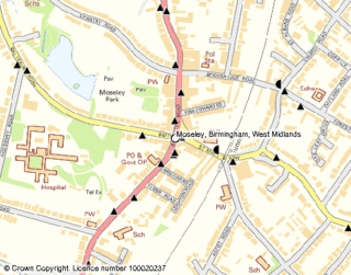
Another source of information relates mainly to rail timetables, but includes other information, and provides a journey planner. Transport Direct Live Travel is a text bulletin that provides brief notices about road, rail and public transport conditions throughout the UK. Other site features include journey planners and maps that show bus stops, taxi ranks, and a wide variety of facilities, services and sites of interest.

The maps are small and somewhat tedious to navigate, particularly in contrast to the size and fluidity of Google maps, but it is nonetheless a useful tool! Possibly more current, too.
Both of these are really nice to see, and bring us closer to the kinds of info available to Central and Southern Californians. Bloody hell. One needs a driver and a navigator to keep track of all this stuff!


